 cs
cs 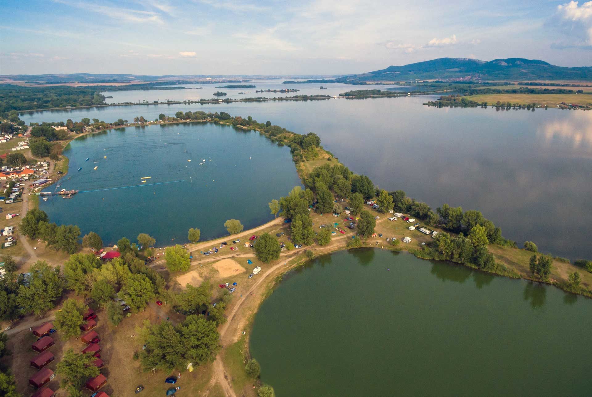
ATC Merkur Bikeways
Route: Pasohlávky – Strachotín – Dolní Věstonice – Pohořelice Fishpond area (junction to Pasohlávky) – Brod nad Dyjí – Pasohlávky
Characteristics:
The ATC Merkur bikeway has two alternatives – the longer green marked circuit has a total length of 27.5 km, and the shorter red circuit is 15.5 km long. The roads are asphalt or field mostly in undemanding flat terrain and are easily accessible on road, trekking and mountain bikes.
Description:
The common starting point is located over the E461 Brno-Mikulov-Vienna road opposite the entrance to the ATC Merkur Camp. Here you will also find a map of both cycling routes. Along the panel road and the old Mušov road, you arrive to the dam of the middle reservoir and you turn left along the road with a coarse asphalt surface. On the right, you see the Church of St. Linhart, a remembrance of the flooded Mušov village. The road leads you around the Betlém Natural Monument and you arrive to another natural monument – Dolní Mušovský luh (Lower Mušov Floodplain) Natural Monument – that protects the remains of the floodplain forest at the confluence of the Jihlava and Svratka rivers. On the right you see artificial islands in the area of the former confluence of the Jihlava and Svratka rivers built as part of the greening process of the Nové Mlýny reservoir. The bike trail continues along the bridge over the Jihlava River and crosses the other bridge over the Svratka River. Behind the bridge you turn right and continue along the dam on a bad asphalt road and around the Strachotín pond, which remains on your left hand. You reach a road and turn right to the dam between the middle and lower reservoirs. After that, head towards Dolní Věstonice. In front of the village, your route leaves the road and continues along the dam to the right. On the right side you see islands – a remnant of the important Slavic burial ground Na pískách. Ride along the dam and you reach the Pohořelice fishpond. The route turns right from the dam to the busy road E461 Mikulov – Brno and after a while, the small, red circuit separates from the green one and continues straight on the E461 across the dam between the upper and middle reservoirs and returns to the starting point of both routes. It is necessary to be cautious on the road due to heavy traffic. The large green circuit continues to the left across the Dunajovice stream, and further along the field paths around the upper (Mušov) reservoir. Continue over the next bridge to the right to the pumping irrigation station and straight ahead towards Brod nad Dyjí. The route turns right in front of the village and continues along the road across the dam and then to Pasohlávky. You can reach the starting point taking three ways. Either you continue along the road towards the Brno-Mikulov-Ivaň junction and you return around the Mušov wine cellars, or you can turn past the cemetery to the right, past the cabin settlement and follow the bank to ATC Merkur – back gate (you must pay the entrance fee if you are not the camp guest). The third option is to go to the left behind the cemetery and after 500 m to the right past windbreaks to the peach orchards. At the end of the windbreak, turn left to Hradisko Hill to the waterworks and then follow the unpaved roads down past the vineyards. You will be rewarded with a nice view of Nové Mlýny reservoirs and Pálava.
Got a question? Need a date booking? Call +420 519 427 714 or send us an e-mail to